
FLS200
OUR PRODUCT AS A SERVICE
EOLOS FLS200
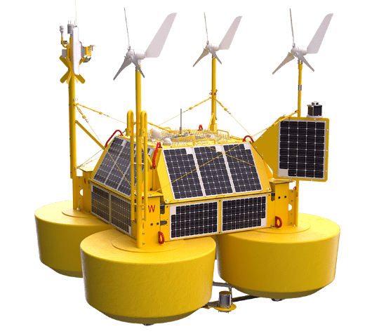
A Stage 3+ buoy designed specifically for the offshore wind industry
The EOLOS FLS200 has been purposely designed exclusively for the needs of the offshore wind industry, ensuring proper dynamics for wind measurements, while minimizing both CAPEX and OPEX of offshore wind measurement campaigns. This is achieved through its innovative light-weight, compact structure with the necessary robustness to withstand the harshest offshore environments for a completely autonomous wind resource measuring campaign, anywhere in the world.
Accredited quality processes
EOLOS adopts rigour in its business processes, achieving and maintaining accredited certification for ISO 9001, ISO14001, ISO45001 and ISO27001.
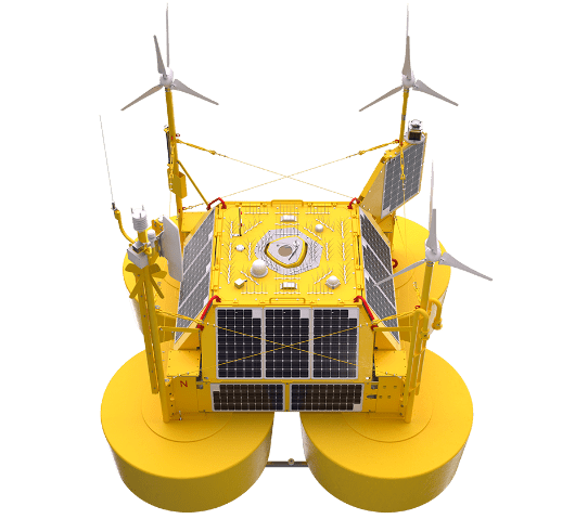
All-in-one system (wind, metocean and environment)
Equipped with fully autonomous and remote sensing devices the EOLOS FLS200 provides wind, validated wave and current flow information in parallel with local real-time meteorological data.
Wind measurement at height
The EOLOS FLS200 uses the market leading ZX Lidars 300M continuous wave LiDAR, which has a proven track record in meteorological offshore applications.
Metocean
With validated wave sensors and industry standard ADCP devices and a meteorlogical station the FLS200 provides real-time metocean data as an integral sensor suite.
Environmental
The site assessment can include wildife observations above the ocean (via acoustic or visual recording) of avian activity or below the ocean via hydrophones to detect tagged or untagged marine species.
Water quality can also be logged using buoy mounted multi-probe oxygen and salinity measuring devices.

Versatile
Requires just a few weeks to get authorised and installed with easy re-deployment during the measuring campaign.
Fully autonomous
The EOLOS FLS200 is powered by means of renewable energy sources and batteries, which assure full autonomy.
Easy transport & deploy
Modular structure providing a low weight system, easy to install by means of readily available vessels at any industrial harbor.
Wind resource measurements
- Lidar Type: ZX Lidars 300M
- Wind speed and direction at height up to 300m
- Turbulence intensity correction validated by DNV
Metocean measurements
- Wave height
- Wave periodicity
- Wave directional spectra
- Current flow throughout the water column
- Water and air temperatures
- Other meteorological attributes
Data communication
- Satellite / 4G / WiFi via EOLOS Digital Hub
Environmental monitoring
- Bird and bat monitoring
- Marine mammal monitoring
- Fish nanotag detection
- Water salinity, turbidity, oxygen and chlorophyll
- Marine growth tendency
Marine approvals
- RAL 1023 Yellow
- Fully compliant with IALA
- Radar reflector
- Marine lantern
- Redundant GPS Location
- Drift alarm

Measurements
0 – 10 metres (onboard met weather station)
± 7.70 metres @ 100 metres
1 Additional met weather station measurement
10 Minute averaging